
Exploring the Exciting Upcoming New Feature on Google Maps
we will take a closer look at the upcoming new features on Google Maps and explore how they will revolutionize the way we navigate the world.
Introduction
In today's fast-paced world, Google Maps has become an indispensable tool for navigating the globe. Whether you're looking for directions to a new restaurant, planning a road trip, or exploring a foreign city, Google Maps has been our trusted companion. Google Maps is a web mapping platform and consumer application offered by Google. It offers satellite imagery, aerial photography, street maps, 360° interactive panoramic views of streets (Street View), real-time traffic conditions, and route planning for traveling by foot, car, bike, air (in beta) and public transportation. As of 2020, Google Maps was being used by over one billion people every month around the world And now, there's even more reason to be excited as Google prepares to introduce a host of new features that will enhance our mapping experience like never before. In this blog post, we will take a closer look at the upcoming new features on Google Maps and explore how they will revolutionize the way we navigate the world.
Background of google map
Google Maps first started as a C++ program designed by two Danish brothers, Lars and Jens Eilstrup Rasmussen, and Noel Gordon and Stephen Ma, at Sydney-based Where 2 Technologies. It was first designed to be separately downloaded by users, but the company later pitched the idea for a purely Web-based product to Google management, changing the method of distribution. In October 2004, the company was acquired by Google Inc. where it transformed into the web application Google Maps.The launch of Google Maps was first announced on the Google Blog on February 8, 2005.
In September 2005, in the aftermath of Hurricane Katrina, Google Maps quickly updated its satellite imagery of New Orleans to allow users to view the extent of the flooding in various parts of that city.
Below, we will discuss some incredible upcoming features on Google Maps that promise to amaze and enhance our navigation experience.
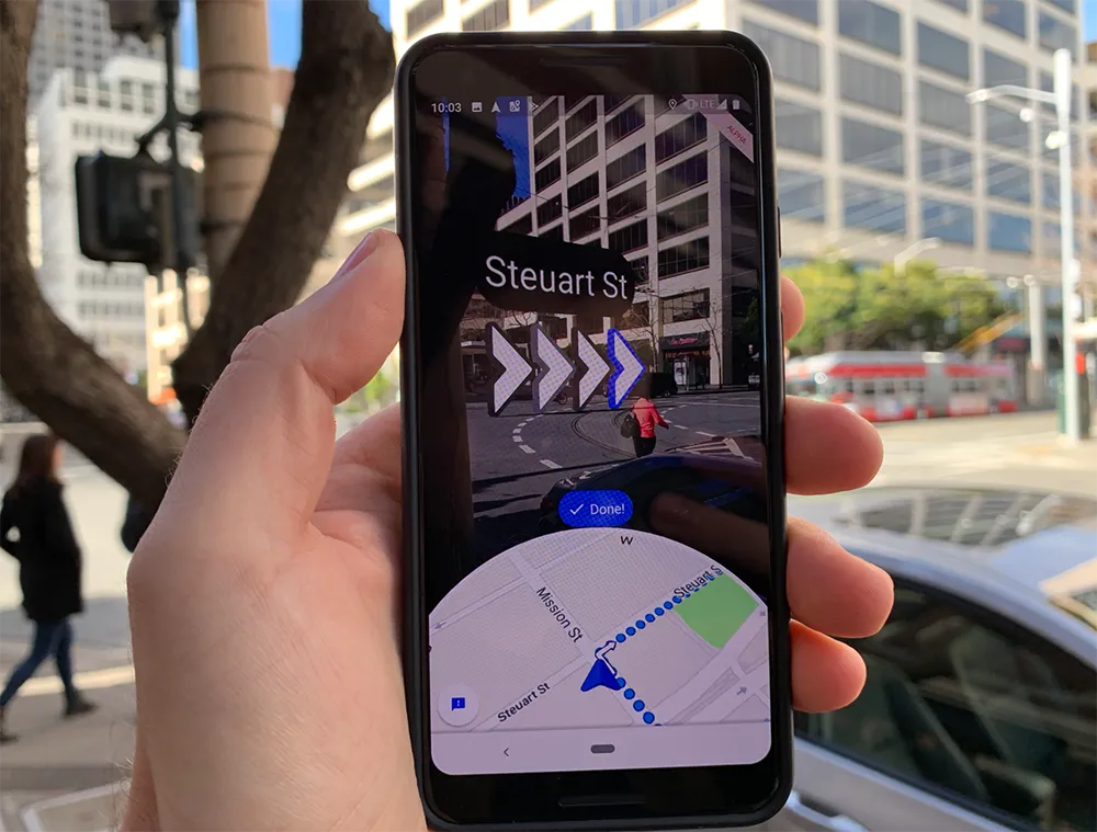
Augmented Reality Navigation
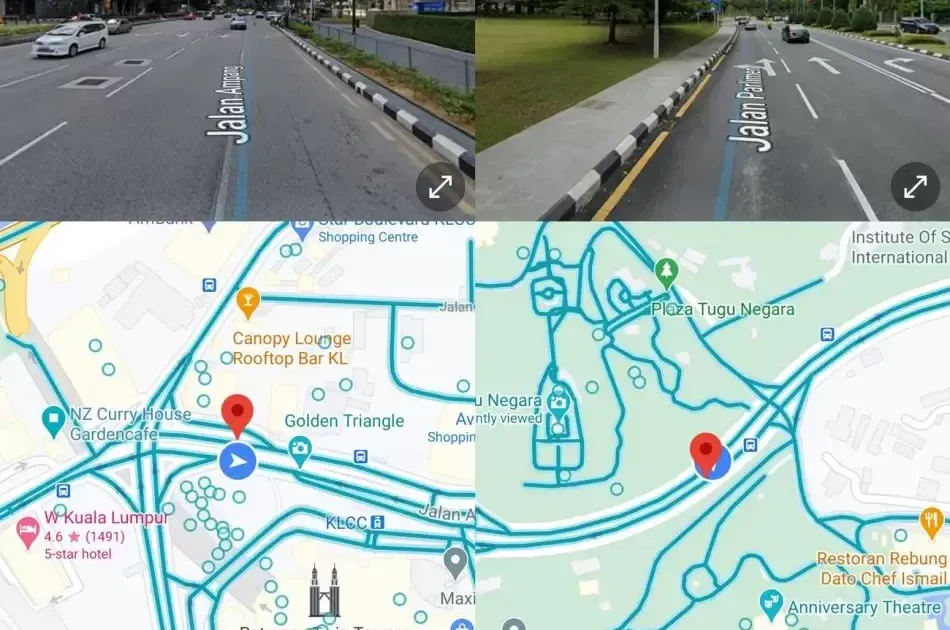
Google Maps AR or Live View is designed to let you use augmented reality to help you navigate when walking. What does that mean? Well, it uses the camera on the rear of the phone to identify where you are, superimposing directions and details on the display, rather than just presenting you with a map.AI identifies what you can see, while the GPS helps position you on the map. Ultimately, Google Maps Live View helps get around that problem of not knowing which way to walk - because the AR can point in the right direction so you're heading the right way.
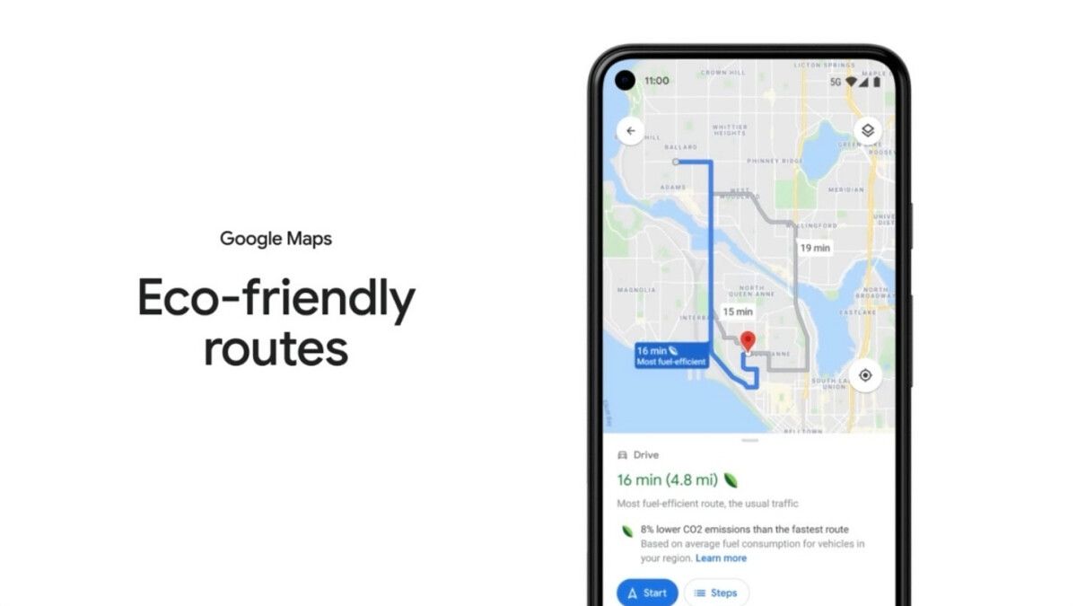
Eco-Friendly Routes
Eco-friendly routes, first introduced to U.S.-based users last year, offer to show more fuel-efficient routes instead of the fastest ones. Users can see the eco-friendly route marked with a leaf label. The Google Maps app shows fuel or energy-efficiency estimates on some routes based on your vehicle’s engine type. The more fuel or energy-efficient the route, the lower your car’s fuel/energy usage and CO2 emissions.
If this feature is turned on, Maps uses fuel or energy-efficiency on top of other factors like real-time traffic and road conditions to choose the best route for you. So besides showing you the fastest route, it will also show you the most efficient one, even if they aren't the same.
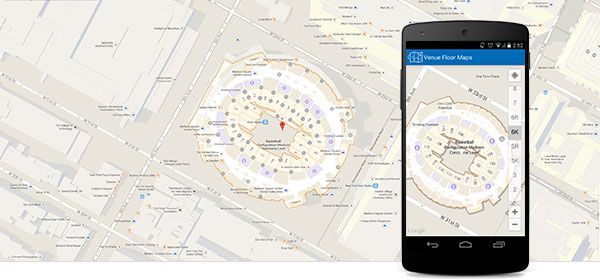
Indoor Navigation
Google unveiled its interior mapping initiative and self-publishing tool, Google Maps Floor Plans. With Google Maps Indoor, you can carry a smart and convenient directory everywhere with you at all times. When you use the Google Maps app on iOS or Android and zoom in on a building with indoor map data, detailed floor plans will appear automatically. The Indoor Google Maps is the best Google Maps alternative for the indoors of larger venues. Google allows businesses to submit floor plans, particularly for large venues with high footfall, such as airports, shopping malls, and sports stadiums. These floor plans are transformed into indoor maps, highlighting points of interest. Users can easily navigate through different floors or levels. Businesses are responsible for keeping their listings updated and submitting their floor plans to Google for inclusion in Google Maps indoor.
Indoor navigation holds significant importance
- Zoom in to navigate
Zoom in to see the indoor floor plan of a building. You can also search within the building once you’re fully zoomed in.
2. Improved location accuracy
Digital directory in the palm of your hand
3. Switch floors with a tap
Use the level switcher in the bottom right-hand corner to move from floor to floor in the building.
4. Universal icons
Easily recognizable symbols represent different points of interest inside
Enhanced Public Transit Information
With Google Transit, users can view public transportation options within Google Maps to help them plan the best routes to get where they’re going. With Google Maps’ combined schedule and route data, your transit information becomes easily accessible to millions of Google users in dozens of languages on both computer and mobile devices.
Google Transit lets you plan trips easier for your passengers with stops, routes, schedules and fare information integrated into Google Maps. Participating transit agencies can do the following:
- Reach more passengers: Google Transit works with your existing trip planner and links users to your website, which helps new and experienced passengers discover your services.
- Provide worldwide coverage: Google Transit covers transit agencies all over the world in one view. Google Maps supports multiple languages, which lets users plan trips in their native language without the need to learn a new system.
- Partner with Google Transit at no charge: Google Transit participation is available to any agency that provides public transportation services and operates with fixed schedules and routes. It’s simple and comes at no charge, and all it takes is your data.
Conclusion
The upcoming new features on Google Maps are set to transform our navigation experience and provide us with even more convenience and accuracy. With augmented reality navigation, eco-friendly route suggestions, indoor navigation, and enhanced public transit information, Google Maps will continue to solidify its position as the go-to app for exploring the world around us. These innovations demonstrate Google's commitment to continually improving its mapping services and helping us navigate with ease, whether we're exploring a new city or simply finding our way home.
So, get ready to embark on exciting new journeys with Google Maps and stay tuned for the release of these amazing features that are sure to enhance our daily lives.
Remember, the world is at your fingertips, and with the upcoming updates on Google Maps, it will be easier than ever to navigate it seamlessly!
Disclaimer: The information in this blog post is based on the latest available updates and features announced by Google Maps. Features and availability may vary depending on the user's location and device.